
Wall Neighbors Record Sources
Public records can describe the block around a Wall address, but each source has a narrow job. Parcel geometry identifies land and the lots that touch or face it. The tax route can show an owner of record and a mailing field. A deed records a property-interest transaction. Voter material is a civic clue subject to law, not a parcel-by-parcel household list. Community bodies and historical collections provide local context when an official source actually identifies them. Keep an owner, an occupant, a voter, and an organization member as separate categories.
| Block source | What it can show around a Wall address | Access route |
|---|---|---|
| Monmouth County GIS | Parcel polygon, block and lot, adjacent polygons, and visible layer attributes | County viewer; inspect displayed fields only |
| County tax roll | Street, owner, block and lot, township, year, and tax category | Online mode; no ZIP selector was located |
| OPRS deed index | Recorded instruments, grantor, grantee, legal description, and date | Online coverage has date limits; older material needs alternatives |
| New Jersey voter route | Permitted registration and district evidence | Exact matching and statutory exclusions apply |
| Wall civic and historical sources | Official municipal bodies or dated local context | Municipal page, library, historical society, or archive |
For immediate Wall neighbors, use the map and tax record as a parcel trail, not a roster. A mailing address may be outside Wall, an owner can be a company or trust, and a property record does not list every person connected to a home. If a historic block needs more than an adjacent-parcel view, a dated directory, census, obituary, or library collection can establish a connection for its own time.
Map Wall Neighbor Parcels
The county GIS viewer is Wall’s primary spatial route. Select the starting parcel, use identify or click, turn on parcel and road layers, and inspect polygons that share a boundary or face the same road. Record the map scale, access date, parcel ID or block and lot, and only attributes that are visibly public. The county property-search Map mode supplies another method: zoom, right-click a location, then choose a radius. Map geometry helps orient the research, but it is not a survey.
- Locate the Wall address in the county GIS or OPRS property map, and save the starting block and lot with the map date.
- Identify parcels that touch the parcel or face it across the road. Mark those two relationships separately because they answer different neighborhood questions.
- Open the tax or property route for each block and lot, preserving the owner, situs, mailing, and year fields exactly as shown.
- Repeat an OPRS deed search only when a recorded property-interest question remains, checking the document type before treating it as a transfer.
A blank owner field can be a Daniel’s Law redaction rather than an error. For a complete named-street record chain, the Wall streets directory follows the address workflow beyond the immediate block. This block method stops at the surrounding parcels and avoids turning a visual radius into a claim about every neighbor.
Note: Treat parcels that touch, face, or fall within a selected radius as separate relationships and label each one in the research log.
Wall Neighbor Tax Roll
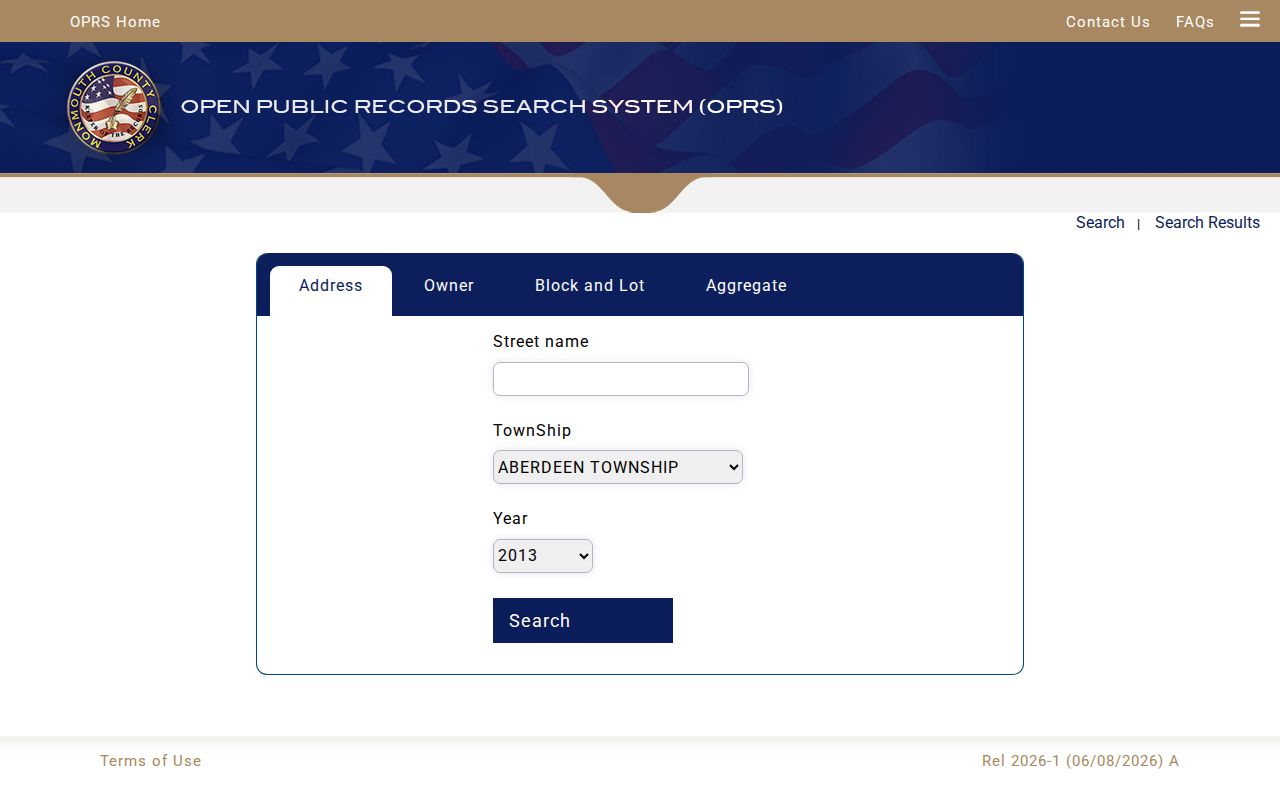
The Monmouth County tax-board search is the closest official block-level roll identified for a Wall neighborhood search. Its street mode accepts street name, township, and year. Owner mode uses owner name, township, year, and a tax-exempt choice. The block-and-lot route uses block, lot, qualifier, exempt selector, township, and year. Its listed exempt options are Regular, Exempt, RailRoad, and Telephone. No ZIP search field was found, so use the township and parcel fields instead.
The official county tax-roll interface shows the Wall search route for street, owner, and block-and-lot research.
Use the year field as part of the finding. A tax record can show the owner and category for that roll year, but it does not establish every person at the property. Qualifier is especially important for a unit or otherwise qualified parcel. Retain it rather than assuming a street number identifies one whole property.
Note: Save the township, year, block, lot, qualifier, and search mode so a repeat search can distinguish a changed result from a changed method.
Wall Neighbor Voter Boundaries
New Jersey voter material is civic evidence, not a full block roster. The official registration check depends on exact name matching, and official guidance notes that date of birth, city, county, and the county-provided spelling can affect a result. Election records may show permitted name, address, party, ward, and district fields, subject to exclusions. A nearby address or district result may support registration at the time searched, but it does not establish property ownership or every person who lives on a block.
Wall’s 2026 voting-district page lists districts 1 through 23 and facilities including the municipal building, South Wall Banquet Hall, Youth Center, Wall Fire Company, First Aid, the library, Glendola Fire House, and Four Seasons at Wall. Those facilities provide election geography when orienting a neighborhood. They are not a resident directory. If a public list request is appropriate, ask the Monmouth election office for the permissible fields, reproduction charge, and Daniel’s Law redactions under N.J.S.A. 19:31-39.
Wall Neighbor Civic Bodies
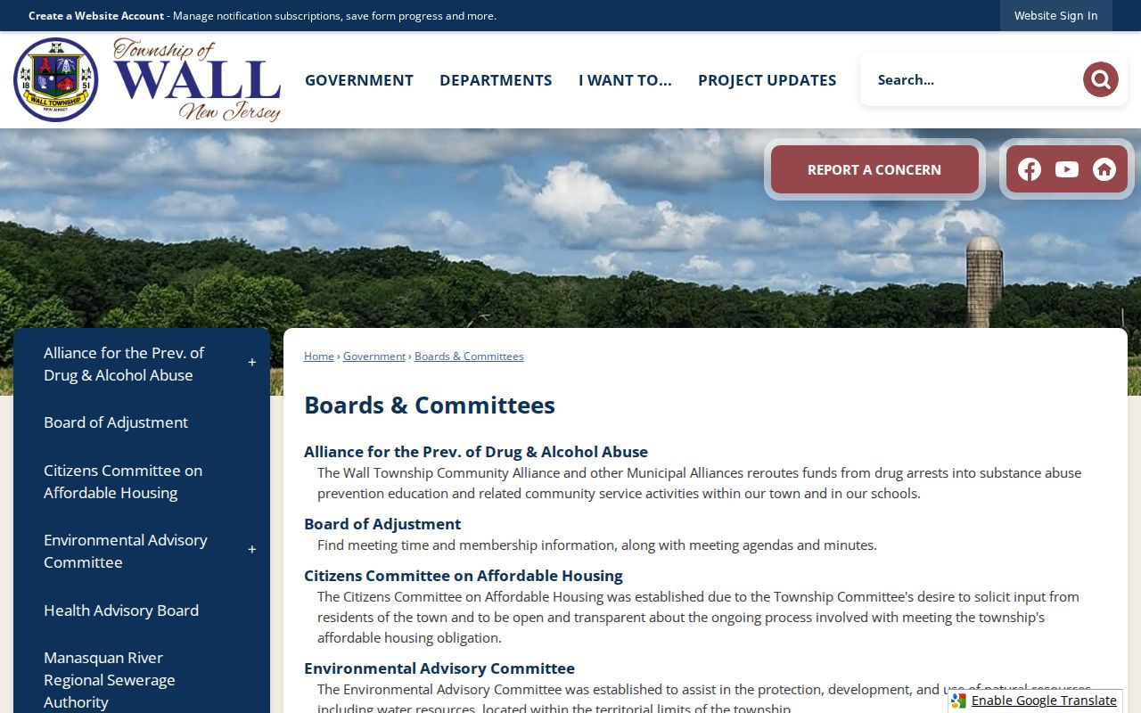
Wall’s official Boards & Committees page is the confirmed community-directory layer. It identifies public municipal bodies, including the Environmental Advisory committee, Planning Board, Zoning Board, and Community Alliance. The Community Alliance for Prevention of Drug & Alcohol Abuse page lists 2026 members and cites NJSA 40:48-2 and Wall Code 6-27 through 6-36. These are official civic affiliations, not a directory of private households.
Environmental Advisory
Municipal advisory body listed through Wall’s official boards and committees inventory.
Planning Board
Official land-use body, useful for civic context rather than private-address research.
Zoning Board
Official municipal board identified on the Wall community-bodies page.
Community Alliance
Official prevention alliance with a listed 2026 membership roster and municipal authority.
The Wall municipal boards inventory documents the official civic bodies available for neighborhood context.
No official master directory of private Wall homeowners’ or neighborhood associations was located. Do not fill that gap with unverified listings. An association name belongs in a block record only when an official municipal source, recorded declaration, or organization source confirms it.
Note: Municipal boards identify civic participation, while a private-association name requires its own confirmed source and must not be inferred from location.
Wall Neighbor Tool Comparison
Official records and commercial neighbor tools serve different purposes. A county source identifies its custodian, date, search mode, and access limit. A commercial compiled profile can combine old addresses, relatives, and names without making those choices visible. For Wall neighbors, a source with a stated record date is more useful than a broad match that does not explain where an address came from.
| Official Wall-area record | Commercial compiled category | How to treat the result |
|---|---|---|
| Parcel or tax roll | May merge address history and names | Use the official roll for a dated owner or parcel fact. |
| Deed or court index | May omit custodian or document date | Read the official record for its stated event, not as a residence label. |
| Voter or civic source | May flatten protected or old data | Respect statutory exclusions and the source’s access boundary. |
The comparison matters most when names repeat. A deed, voter record, court docket, directory, and license record each identify a different relationship to a person or place. Match two independent facts and retain the source caveat instead of collapsing them into one claim about a Wall neighbor.
Wall Neighbor Locality Clues
Wall blocks may be described with more than one locality or postal term. Official documents name Algers Mill, Allaire, Allenwood, Atlantic Avenue Circle, Glendola, New Bedford, Shark River, West Belmar, and many others. An older reference can use the nearest village, post office, road, or former boundary instead of Wall Township. Preserve the printed form first, then search the township, county, parcel, and postal fields separately.
Allaire deserves special care because it can be a locality, a road, or a historical reference. The Wall library branch shares the municipal-complex address and offers public computers, scanning, and Wi-Fi for county or state records; the secured Historical Room at Headquarters supplies non-circulating material. That fallback is useful when a local name does not resolve cleanly in an online parcel view.
Note: Retain the printed locality, postal city, township, and parcel fields separately when comparing older records with current Wall maps.
Wall Neighbor Privacy Limits
A block record has firm privacy boundaries. Property data can name the owner of record, but it does not identify every occupant. Daniel’s Law requires government sites to shield covered home addresses and unpublished phone numbers, and New Jersey’s April 2025 milestone described continuing redaction work across state, county, and local records. A hidden or blank field should be recorded as protected or redacted when the official source says so. It is not a prompt to infer an address from another record.
New Jersey’s Safe at Home program uses a substitute address and mail forwarding for eligible participants. OPRA also protects sensitive personal data, and voter, court, and vital records have their own access rules. A defined request for an existing Wall record may be appropriate through the custodian, but an OPRA request cannot defeat Safe at Home or Daniel’s Law protections. Stop when the custodian identifies information as exempt or protected.
Lawful use. Use Wall neighbor records for personal, lawful research and civic context. Do not watch, stalk, harass, intimidate, or harm anyone with information from a public record.
Retain only the minimum field needed to understand a public record. Do not republish full dates of birth, signatures, personal phone or email, financial identifiers, protected addresses, or sensitive information. The best result may be a narrow one: a parcel relationship, an election district, or an official civic body, documented with its date and limit.