
Wall ZIP Code Directory Coverage
Official sources do not establish one clean postal boundary for Wall. The county ZIP list identifies 07719 as Wall, while current Wall municipal records use several additional postal codes at township addresses. The evidence below reports those confirmed appearances, not a complete carrier-route map. A postal code can be useful for checking an address, but only the exact address lookup and municipal parcel information can resolve a particular record.
| ZIP | Wall address evidence | Post Office | Careful reading |
|---|---|---|---|
| 07719 | Monmouth County identifies Wall; Wall municipal offices use it; the Wall license table includes Highway 34 and Highway 35 examples. | Not identified in the research sources | It is the county list’s main Wall entry, not proof that every Wall situs uses it. |
| 07753 | Wall’s license table lists a Wall address at 1302 Campus Parkway, and a 2007 township newsletter mentions a Neptune 07753 mailing option. | Not identified in the research sources | Postal-city wording may reflect Wall or Neptune-style legacy practice; verify the street number. |
| 08736 | Official Wall license records include Blue Peach, Harpoon Willy’s, and Atlantic Club examples. | Not identified in the research sources | Shore and ocean postal geography overlaps township boundaries. |
| 08750 | Wall license records include Tommy’s Tavern + Tap and Sea Girt Wine and Spirits addresses. | Not identified in the research sources | A Sea Girt-associated postal code can appear on a Wall municipal record. |
The Wall ZIP code directory should stop at confirmed evidence. Official Wall-specific examples were not located for several nearby codes, including 08720, 07722, 07727, 07731, 07762, 08724, and 08730. Those numbers should be checked through USPS by exact address, not promoted as township-wide coverage.
Wall Postal Code Evidence
The four confirmed postal numbers illustrate why a municipality field and a postal field need to remain separate. The Wall liquor-license table is especially useful because it displays street address, city, state, and ZIP together. It is a municipal license record, not a resident roll or a parcel search, but it gives direct examples of the different postal conventions used on Wall addresses.
The source table shows 07719, 07753, 08736, and 08750 on records whose municipal field is Wall. That is a geography finding, not a boundary map. An address’s postal place name may relate to Wall, Neptune, Sea Girt, or a shore community while its governmental jurisdiction remains Wall Township.
The Wall liquor-license address table makes the municipality-and-postal distinction visible in one official record format.
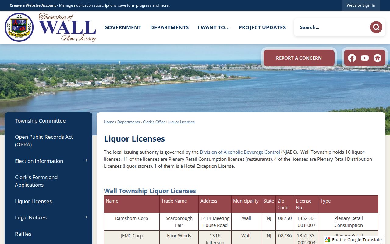
Use this kind of record to preserve how an address was printed. It does not determine property situs, prove who lives there, or substitute for postal verification.
Verify a Wall ZIP
USPS is the practical authority when a ZIP conflict matters. The USPS ZIP Lookup provides city-and-state and address lookup modes. Start with the full house number and street whenever possible. The live Wall result was not exposed during text-only research, so the source supports the lookup method but not a blanket result for every Wall locality.
| USPS lookup path | Research-supported input | Best use in a Wall search |
|---|---|---|
| Address lookup | Exact street address | Check current deliverability and the postal result for one known location. |
| City/state lookup | City and state | Use for a postal starting point, then confirm an individual address. |
The USPS lookup screen is the address-first verification route used before an ambiguous Wall postal record is compared with township data.
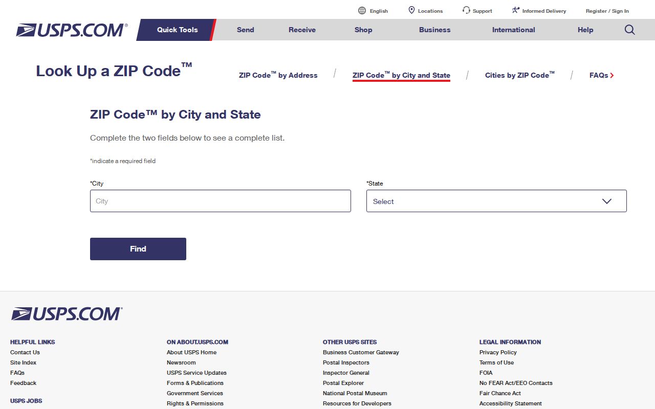
Keep the postal result with the search date. The research did not capture a stable live Wall result in text form, so no unverified post-office assignment or ZIP boundary is inferred from the screenshot.
Wall Postal Portal Limits
Several local public tools are valuable after postal verification, but neither the assessor property search nor the county tax roll exposes a ZIP field in the researched interface. OPRS property search works by township and address, owner, block and lot, or map. The county tax-roll search works by street name, township, and year, or by owner, block and lot, and aggregate categories. Its lack of a postal selector is a useful limit, not a missing shortcut.
| Wall-area tool | Supported search fields | Postal-field status | What it resolves |
|---|---|---|---|
| OPRS property search | Township, address, owner, block/lot, map | No ZIP field located | Current parcel, owner, situs, mailing, assessment, or map context when displayed |
| County tax roll | Street/township/year; owner/township/year; block/lot/qualifier/township/year; aggregate modes | No ZIP field located | Year-specific tax-roll route and parcel identifiers |
| Wall license table | Displayed address, city, state, and ZIP | ZIP is an output field | Municipal-license address examples, not parcel searching |
| State voter search | Official hints name exact spelling, date of birth, city, and county | Current live ZIP field not verified | Registration check, subject to its own rules and exclusions |
The Monmouth tax-roll search shows the street, owner, block-and-lot, and aggregate routes that follow a postal check with property-specific evidence.
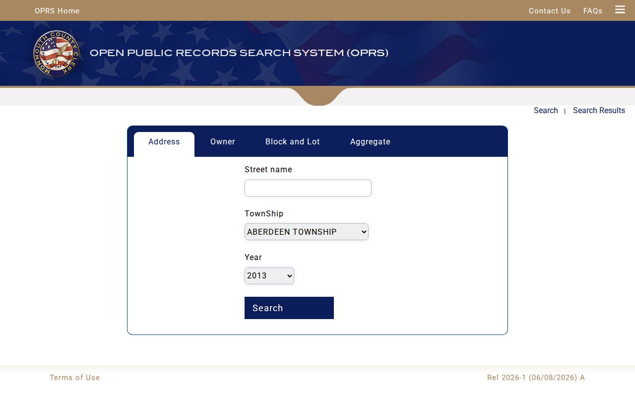
A ZIP is often displayed after the fact, but it is not the search key for this tax portal. Use the current street address and Wall township selection, then retain the tax year and parcel identifiers with the result.
Find Residents in Wall ZIPs
A postal code narrows an address question, not a person search. The researched assessor and tax-roll tools do not offer a ZIP filter, and the current voter form’s field list was not fully exposed. A reliable sequence therefore starts with the exact postal address and proceeds to the official record keyed by township, street, or parcel. It does not infer a list of residents from everyone sharing a postal number.
- Enter the complete known address in the USPS address lookup and retain the current postal wording.
- Search the same street or address in the Monmouth property portal with Wall selected as the township. Record the situs and block-and-lot fields if the result exposes them.
- Use the county tax-roll address mode with street name, township, and year when a year-specific property trail is needed.
- Check the Monmouth GIS parcel location and compare its block and lot with the property result. Use the municipality and county, not the postal result alone, to decide whether it belongs in Wall.
- When the task shifts to a named road rather than a postal area, use the Wall street directory record chain for assessor, GIS, deed, and dated-directory evidence.
New Jersey voter materials may offer a registration and district clue under their statutory rules, but a ZIP-wide roster was not documented. When an official source does not provide a field, a careful search records that limit instead of creating an inferred list.
Wall Locality and Postal Names
Wall’s official locality vocabulary is wider than a single postal label. Records can use Allaire, Allenwood, Glendola, New Bedford, Shark River, West Belmar, Osborn Island, or other locality names. They can also name adjacent places such as Sea Girt or Neptune in the postal line. Search the locality as printed, then compare township, county, street address, and parcel information before treating two similar entries as the same place.
Allaire is a useful example because it can be a historic place, a road term, or part of an address. Retain the original spelling in directory, deed, census, or newspaper notes. A modern postal result should clarify present delivery, not overwrite the locality wording that explains an older Wall record.
Wall Address History Fields
A 2007 Wall newsletter said that the township did not have its own ZIP at that time and that surrounding-municipality ZIPs, including Neptune 07753, could be used. That is a dated mailing practice, not a current USPS boundary statement. The same newsletter gave a more important records lesson: a vital event occurring in Wall belongs with the Wall Registrar even when the postal address uses a surrounding municipality’s number.
For an address that crosses a postal or boundary change, preserve the record trail rather than forcing all years into today’s form. Search old directories by street and locality, deeds by legal description and block or lot, and newspapers using both Wall and the surrounding postal-city term. Confirm modern delivery with USPS, tax situs with Wall or Monmouth property records, and historic jurisdiction through maps, deeds, Archives, and local-history material.
| Address-history field | What to preserve |
|---|---|
| Printed address and postal number | The wording exactly as it appeared in that dated source. |
| Municipal wording | Wall, a locality, or another named jurisdiction in the record. |
| Record year and source | Directory, census, deed, license, newspaper, or other source with an access note. |
| Legal and parcel description | Deed description and current block/lot when the street form changes. |
| Confidence | Whether USPS, assessor, deed, or historical material directly supports the match. |
Note: A postal label can change while the record custodian and parcel identity stay the same, so preserve both rather than replacing one with the other.
Wall ZIP Code Boundaries
ZIP boundaries are delivery geographies, not municipal lines. For a Wall parcel, the reliable check combines exact street address, township, county, and block or lot. For a local vital event, the event jurisdiction controls even if an older address used another postal city. Postal clues still matter because they can reveal an alias or a time period, but they should never be the sole basis for locating a person, property, or government record.
- ZIP versus ZIP+4
- A ZIP is the broader postal code; ZIP+4 adds a more specific delivery segment to that mailing code.
- PO-box ZIP
- A postal code used for post-office boxes, which should not be assumed to describe a property’s physical location.
- Unique ZIP
- A postal code assigned to a single organization or address arrangement; none was confirmed for Wall in the researched sources.
- Carrier route
- A postal delivery grouping that does not define the legal boundary of Wall Township or a parcel.
The Wall ZIP code directory is most useful when it preserves this distinction. USPS confirms delivery; municipal and county records confirm the public-record geography; historical sources explain why the two may look different.